Opening Introduction
Ben's grandpa sends a postcard. It has a beautiful stamp. The stamp is from a faraway place. Ben looks at the postcard. He sees a tall tower. "Where is this?" Ben asks his sister, Mia. Mia does not know. They look at the address. It says "Paris, France". Ben is curious. Where is France? How far is it from their home?
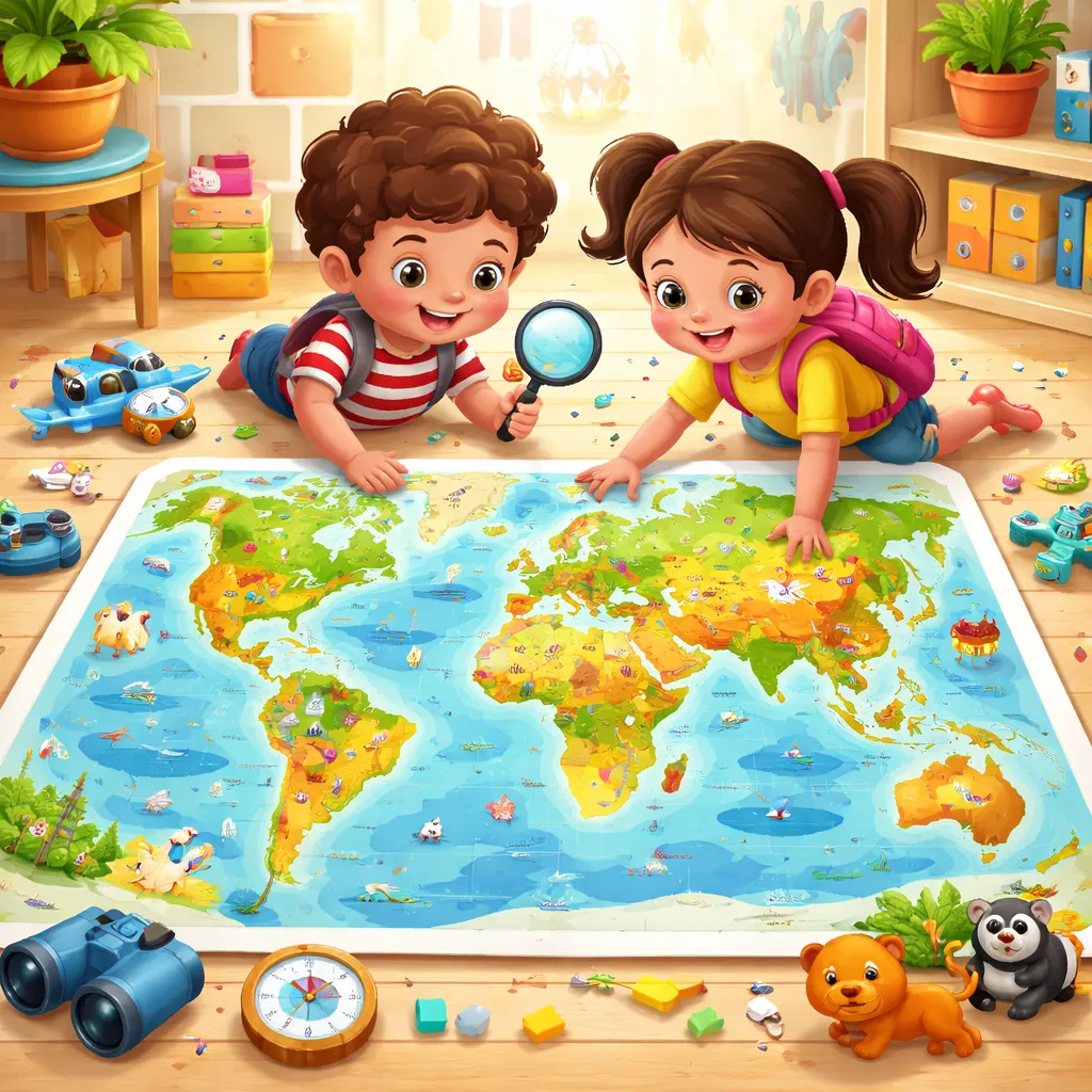
Dad hears the question. "Let's find out together," he says. He goes to the computer. He prints a big, colorful picture. It shows all the lands and oceans. "This is our world," Dad explains. "This is a printable map of the world for kids. It is a picture of our whole planet from above. We can find France here. We can find our home too." Ben and Mia look closely. The map is like a giant puzzle. It is full of strange shapes and names. An adventure is waiting on this paper. Let's go exploring.
Core Knowledge Explanation
What is a map? A map is a special drawing. It shows a place. You can have a map of your town. You can have a map of a park. Our map today is the biggest kind. It is a map of the whole world. The world is our planet, Earth. A printable map of the world for kids is made for you. It is simple, bright, and easy to understand. You can print it. You can color it. You can put it on your wall. It is your window to the world.
Look at the map. You see big areas of blue. Blue is for water. This water is the ocean. There are five big oceans. Their names are the Pacific Ocean, the Atlantic Ocean, the Indian Ocean, the Southern Ocean, and the Arctic Ocean. The Pacific Ocean is the biggest. It is very, very wide. Between the oceans, you see shapes in many colors. These shapes are the continents. Continents are the big pieces of land.
There are seven continents. Their names are North America, South America, Europe, Africa, Asia, Australia, and Antarctica. Let's say them together. North America. South America. Europe. Africa. Asia. Australia. Antarctica. You live on one of these continents. If you live in the United States, you live in North America. If you live in the United Kingdom, you live in Europe. If you live in Japan, you live in Asia. Your printable map of the world for kids will have these names.
Inside the continents, there are countries. A country is a land with its own people and rules. Canada is a country. Brazil is a country. Egypt is a country. China is a country. France is a country. Your map might show some countries. It might show their flags. A flag is a symbol for a country. The map is a picture of our global neighborhood. A neighborhood is where people live close together. The world is a big neighborhood.
Maps have directions. Directions tell you which way to go. The top of the map is North. The bottom is South. The right side is East. The left side is West. People say "North, South, East, West". This helps you find places. If you go from Canada to Mexico, you go South. If you go from England to China, you go East. Your printable map of the world for kids helps you learn these directions.
Maps also have symbols. A symbol is a small picture that means something. A star might mean a capital city. A capital city is the main city of a country. Washington D.C. is the capital of the United States. A picture of a mountain means a real mountain. A blue line means a river. The map is a code. You learn to read the code. It is like a treasure map for knowledge.
Why is this good for learning English? You learn so many new words. You learn geography words. Geography is the study of Earth. Words like continent, ocean, country, city, mountain, river, north, south. You learn the names of places. These names are proper nouns. They start with a capital letter. You learn to say "I live in North America." You learn to ask "Where is Australia?" Your English becomes global.
Fun Interactive Learning
Let's play with your map. First, print your printable map of the world for kids. Get some crayons. Let's color the oceans blue. Color them all a nice light blue. Now, let's color each continent a different color. Color North America green. Color South America yellow. Color Europe red. Color Africa orange. Color Asia purple. Color Australia brown. Color Antarctica white. Now your world is bright and beautiful.
Let's play "Map Detective". Close your eyes. Point to a spot on your map. Open your eyes. Where is your finger? Is it in the middle of the Pacific Ocean? Say, "I am in the Pacific Ocean. It is very big and blue." Is it on the continent of Africa? Say, "I am in Africa. I see the Sahara Desert." Look at that country. What is its name? Can you read it? Ask a grown-up to help. Now, find one fact about that place. A fact is something true. "In Egypt, there are pyramids." You are a detective discovering secrets.
Let's play a traveling game. Get a small toy car or a little toy animal. Place it on your home country. Now, you are the pilot. Your friend says, "Fly to a country that starts with the letter 'I'." You look at the map. You see India. You see Italy. You see Indonesia. Choose one. Move your toy there. Say, "Now I am in Italy. I see pizza and pasta." Your friend says, "Now go to a country in South America." You move your toy to Brazil or Argentina. This game teaches you locations and words.
You can make map flags. Look at the flags of different countries online. Draw a small flag on a piece of paper. Cut it out. Use tape to stick it to the correct country on your paper map. Soon, your printable map of the world for kids will be decorated with flags from around the world. It will be your own international project.
Expanded Learning
People have used maps for a very, very long time. Long ago, maps were drawn on animal skins or on clay tablets. Explorers used maps to find new lands. They often made mistakes. Their maps had sea monsters on the edges because they were afraid of the unknown. Today, we have satellites in space. Satellites take pictures of Earth. Our maps are now very, very accurate. Accurate means correct. Your paper map comes from those space pictures.
Our world has many different people. People speak different languages. In Spain, people speak Spanish. They say "Hola". In China, people speak Mandarin. They say "N走 h見o". In Saudi Arabia, people speak Arabic. They say "Marhaba". But everyone lives on the same planet. Your map shows that we are all connected. We share the same oceans and air.
Let's sing a continent song. Songs help us remember. Sing this to the tune of "Fr豕re Jacques".
Where is North America? Where is South America? Here I am! Here I am! Where is Europe, Africa? Where is Asia, Australia? Here we are! Here we are! Don't forget Antarctica, cold and white, cold and white. That's the world! That's the world!
You can point to each continent on your map as you sing its name. This is a fun and active way to learn.
What You Will Learn
You are learning a world of new words. You are learning geography words. Words like world, map, Earth, continent, ocean, country, city, capital, north, south, east, west. You are learning the names of the seven continents. You are learning the names of many countries like France, Canada, Brazil, India, Japan, Australia, Egypt.
You are learning useful sentences. You can say, "I live in [Your Country]." You can ask, "Where is [Country Name]?" You can describe, "This is a map of the world." You can explain, "Africa is a continent. The Nile River is in Africa." Your sentences are becoming smart and full of information.
You are building important skills. You are building spatial awareness. Spatial means understanding where things are. You see that Canada is above the United States. You are building cultural awareness. You learn that different people live in different places. You are building research skills. You look at the map to find an answer. You are building your English vocabulary in a big, big way.
You are forming a wonderful habit. The habit is curiosity about the world. You see a name on the map. You wonder, "What is it like there?" You find a book. You ask a question. You learn. This habit makes you a global citizen. A global citizen cares about the whole world. Your printable map of the world for kids is the first step to becoming one.
Using What You Learned in Life
Use your map knowledge every day. When you watch the news or a cartoon, listen for place names. "This story is about a panda in China." Run to your map. Find China. Point to it. Say, "China is in Asia. It is very big." You are connecting TV to real learning.
When you get mail or a package, look at the stamp or the label. Where did it come from? Find that place on your map. Put a small sticker there. Your map will show all the places that have sent you things. It is a map of your friendships.
At school, you can be the geography expert. If your class reads a story about Mexico, you can show everyone where Mexico is on the world map. You can say, "Mexico is in North America. It is south of the United States." Your teacher and friends will be impressed.
In the car, use your direction words. "The sun sets in the West." "We are driving North to visit grandma." The world outside your window is connected to the map in your mind. Always ask questions. "What country would be on the other side of the world if I dug a hole here?" Your map can help you imagine the answer. It makes you think in new ways.
Closing Encouragement
You have done something amazing today. You are an explorer. You are a map reader. You are a global learner. I am so incredibly proud of you. Your paper map is a magic carpet. It can take your mind anywhere. It is full of stories and adventures waiting for you.
Keep your map on your wall. Look at it often. Add stickers to places you learn about. Draw a picture of an animal that lives there. Your map is a living, growing project. It shows how much you are learning.
Remember, the world is a big, beautiful place. And you are an important part of it. You can talk about it in English. You can find any place on your map. You are brave, you are curious, and you are smart. Fantastic work, my wonderful world explorer. Your next journey starts with a single look at your map. Where will you go tomorrow?